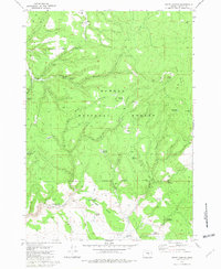
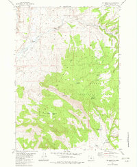
1981 Map of Egypt Canyon
USGS Topo · Published 1981About this map
Ochoco National Forest lands dominate this high-desert landscape in Harney County, characterized by a complex network of seasonal water management and rugged drainage systems. The 1981 survey reveals a territory defined by high-elevation cattle ranching and resource management, marked by numerous named catchments like Blue Bucket Reservoir, Dead Bull Reservoir, and Egley Reservoir. These water sources, along with improved points such as Gus Well and Bald Butte Waterhole, indicate the vital infrastructure required for range operations in this arid region.
Find a feature on this map
37 named features on this map. Tap any name to fly to it.
Don’t see what you’re looking for? This feature index may not catch every label — zoom into the map to look around manually.
Map Details
Editions of this 1981 Egypt Canyon Map
This is the sole edition of this map. No revisions or reprints were ever made.
Other maps of this area

1955 · Burns
USGS Topo · 1:250,000

1958 · Burns
USGS Topo · 1:250,000

1959 · Burns
USGS Topo · 1:250,000

1959 · Sawtooth Creek
USGS Topo · 1:62,500

1961 · Delintment Lake
USGS Topo · 1:62,500

1981 · Sage Hen Hill
USGS Topo · 1:24,000
1981 · Oakerman Lakes
USGS Topo · 1:24,000
1981 · Holmes Canyon
USGS Topo · 1:24,000
1981 · Riley
USGS Topo · 1:24,000
1982 · Dry Mountain
USGS Topo · 1:24,000