
1961 Map of Delintment Lake
USGS Topo · Published 1962About this map
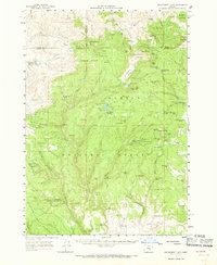
Delintment Lake sits at the heart of this high-elevation forest landscape, surrounded by a complex network of springs and drainage systems within the Malheur National Forest. In the early 1960s, this area of the Ochoco Mountains served as a managed wilderness and recreational hub, evidenced by the Youth Camp on the lake's southern shore and several designated campsites such as Mutton Camp and Donnelly Camp. The map reveals a reliance on forest service infrastructure, including the Allison Guard Sta and Buck Spring Guard Sta. The terrain is defined by prominent peaks like Snow Mtn and Iron Mtn, while the presence of Duffy Prairie and Boone Prairie highlights the natural openings in the dense timber. A solitary Grave noted near Gilchrist Spr provides a quiet connection to the area's human history amidst the peaks of the Blue Mountains.
Find a feature on this map
125 named features on this map. Tap any name to fly to it.
Don’t see what you’re looking for? This feature index may not catch every label — zoom into the map to look around manually.
Map Details
Editions of this 1961 Delintment Lake Map
2 editions found
Other maps of this area

1932 · Dayville
USGS Topo · 1:125,000

1936 · Dayville
USGS Topo · 1:125,000

1955 · Burns
USGS Topo · 1:250,000

1955 · Canyon City
USGS Topo · 1:250,000

1958 · Burns
USGS Topo · 1:250,000

1959 · Burns
USGS Topo · 1:250,000

1959 · Canyon City
USGS Topo · 1:250,000

1959 · Sawtooth Creek
USGS Topo · 1:62,500

1961 · Izee
USGS Topo · 1:62,500

1981 · Suplee
USGS Topo · 1:24,000