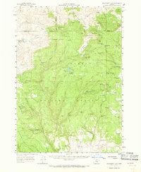
1961 Map of Delintment Lake
USGS Topo · Published 1968About this map
Ochoco National Forest and Malheur National Forest dominate this high-altitude landscape where Crook, Grant, and Harney counties converge. The 1961 field check documents a wilderness managed for both recreation and fire watch, centered on the Delintment Lake recreation area and its associated campgrounds and Youth Camp. Strategic outposts like Allison Guard Sta, Dobson Guard Sta, and Buck Spring Guard Sta appear alongside a network of lookouts and jeep trails. The terrain is marked by numerous peaks, including Snow Mtn and Big Mowich Mtn, while the water resources are defined by a high density of named springs such as Warm Sprs and Allison Spr. Temporary seasonal sites like Donnelly Camp and Cow Camp highlight the area's history of livestock grazing and timber management.
Find a feature on this map
127 named features on this map. Tap any name to fly to it.
Don’t see what you’re looking for? This feature index may not catch every label — zoom into the map to look around manually.
Map Details
Editions of this 1961 Delintment Lake Map
2 editions found
Other maps of this area

1932 · Dayville
USGS Topo · 1:125,000

1936 · Dayville
USGS Topo · 1:125,000

1955 · Burns
USGS Topo · 1:250,000

1955 · Canyon City
USGS Topo · 1:250,000

1958 · Burns
USGS Topo · 1:250,000

1959 · Burns
USGS Topo · 1:250,000

1959 · Canyon City
USGS Topo · 1:250,000

1959 · Sawtooth Creek
USGS Topo · 1:62,500

1961 · Delintment Lake
USGS Topo · 1:62,500

1961 · Izee
USGS Topo · 1:62,500