
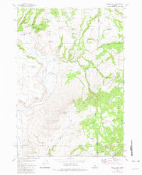
1981 Map of Suplee
USGS Topo · Published 1981About this map
Suplee (Site) sits at the center of this 1981 survey, marking a location where a remote high-desert community once gathered. The landscape here is defined by high plateau formations and volcanic features, including Shaw Table, Colpitts Butte, and Weberg Butte. The importance of water in this arid environment is evident from the concentration of resources like Suplee Hot Spring, O'Henry Reservoir, and Delore Spring.
Find a feature on this map
40 named features on this map. Tap any name to fly to it.
Don’t see what you’re looking for? This feature index may not catch every label — zoom into the map to look around manually.
Map Details
Editions of this 1981 Suplee Map
This is the sole edition of this map. No revisions or reprints were ever made.
Other maps of this area

1932 · Dayville
USGS Topo · 1:125,000

1936 · Dayville
USGS Topo · 1:125,000

1955 · Burns
USGS Topo · 1:250,000

1955 · Canyon City
USGS Topo · 1:250,000

1958 · Burns
USGS Topo · 1:250,000

1959 · Burns
USGS Topo · 1:250,000

1959 · Canyon City
USGS Topo · 1:250,000

1961 · Delintment Lake
USGS Topo · 1:62,500
1981 · Powell Mtn
USGS Topo · 1:24,000

1981 · Dayville
USGS Topo · 1:100,000