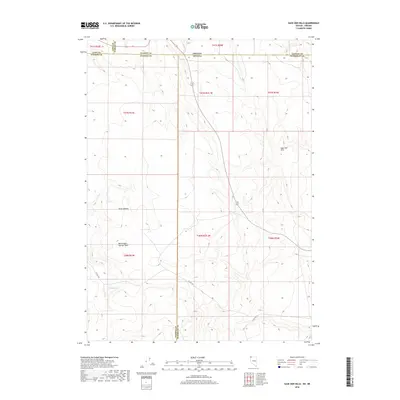
2018 Map of Sage Hen Hills
USGS Topo · Published 2018About this map
Sage Hen Hills dominates the eastern edge of this high-desert landscape where the borders of Nevada and Oregon meet. This 2018 survey documents a remote corner of the Great Basin where the tri-county corner of Washoe, Humboldt, and Harney counties converges. Notable landforms include the expansive North Rock Springs Table and the uniquely named Horse Heaven in the central part of the quadrangle. Water is scarce in this arid environment, marked only by isolated features such as Rock Spring and the ephemeral North Lake. The map details the primitive road network, including Co Rte 34A and Co Rte 8A, which provide the primary access through this sparsely settled region of the high plateau.
Find a feature on this map
23 named features on this map. Tap any name to fly to it.
Don’t see what you’re looking for? This feature index may not catch every label — zoom into the map to look around manually.
Map Details
Editions of this 2018 Sage Hen Hills Map
This is the sole edition of this map. No revisions or reprints were ever made.
Other maps of this area

1889 · Long Valley
USGS Topo · 1:250,000

1954 · Vya
USGS Topo · 1:250,000

1955 · Adel
USGS Topo · 1:250,000

1957 · Adel
USGS Topo · 1:250,000

1958 · Vya
USGS Topo · 1:250,000

1958 · Adel
USGS Topo · 1:250,000

1962 · Vya
USGS Topo · 1:250,000

1962 · Adel
USGS Topo · 1:250,000

1966 · Catnip Canyon
USGS Topo · 1:24,000

1966 · Swan Lake
USGS Topo · 1:24,000