
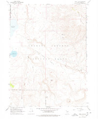
1966 Map of Swan Lake
USGS Topo · Published 1968About this map
Charles Sheldon Antelope Range defines this high desert landscape in northwestern Nevada, dominated by the expansive Antelope Table and the heights of Catnip Mountain. The map illustrates a remote environment where survival and navigation rely on scattered water sources such as West Catnip Spring, Murdock Spring, and Antelope Spring. While largely uninhabited, the presence of Andys Place along a primitive track provides a rare instance of named settlement amidst the drainage basins of Fish Creek and Badger Creek.
Find a feature on this map
18 named features on this map. Tap any name to fly to it.
Don’t see what you’re looking for? This feature index may not catch every label — zoom into the map to look around manually.
Map Details
Editions of this 1966 Swan Lake Map
2 editions found
Other maps of this area

1889 · Long Valley
USGS Topo · 1:250,000

1954 · Vya
USGS Topo · 1:250,000

1958 · Vya
USGS Topo · 1:250,000

1962 · Vya
USGS Topo · 1:250,000

1966 · Catnip Canyon
USGS Topo · 1:24,000

1966 · Bald Mountain
USGS Topo · 1:24,000
1966 · Rye Creek
USGS Topo · 1:24,000

1966 · Badger Mtn NW
USGS Topo · 1:24,000

1966 · Massacre Lake
USGS Topo · 1:24,000

1966 · Blowout Mtn
USGS Topo · 1:24,000