
1966 Map of Blowout Mtn
USGS Topo · Published 1969About this map
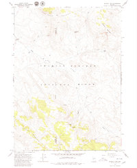
The Charles Sheldon Antelope Range dominates this mid-1960s landscape, straddling the county line between Washoe and Humboldt Counties. This high-desert terrain is defined by a series of prominent peaks and basins, including Badger Mountain and the distinct volcanic contours of Blowout Mountain. The presence of Badger Cabin and a Gaging Station indicate the sparse but essential human activity in a region where water sources like Cottonwood Spring and Smith Lake are vital landmarks.
Find a feature on this map
19 named features on this map. Tap any name to fly to it.
Don’t see what you’re looking for? This feature index may not catch every label — zoom into the map to look around manually.
Map Details
Editions of this 1966 Blowout Mtn Map
2 editions found
Other maps of this area

1889 · Long Valley
USGS Topo · 1:250,000

1954 · Vya
USGS Topo · 1:250,000

1958 · Vya
USGS Topo · 1:250,000

1962 · Vya
USGS Topo · 1:250,000

1965 · Rock Spring Table
USGS Topo · 1:62,500

1966 · Swan Lake
USGS Topo · 1:24,000

1966 · Badger Mtn NW
USGS Topo · 1:24,000

1966 · Big Spring Butte
USGS Topo · 1:62,500

1966 · Nut Mountain
USGS Topo · 1:24,000

1966 · Badger Mtn SE
USGS Topo · 1:24,000