
1966 Map of Badger Mtn NW
USGS Topo · Published 1968About this map
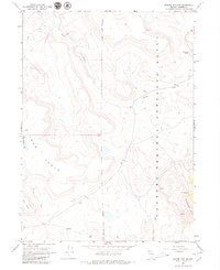
Bitner Ranch serves as a lone human waypoint in this mid-1960s survey of the high desert of northwestern Nevada. The landscape is dominated by the Charles Sheldon Antelope Range, a wildlife refuge where the terrain rises from drainage basins to the elevated Bitner Table. Water remains the critical factor for both ranching and wildlife in this arid environment, evidenced by scattered water sources like Post Camp Spring, North Spring, and Fatty Martin Lake. A network of seasonal drainages including Badger Creek and Wash Canyon Creek cut through the volcanic plateaus. Aside from a few Jeep Trails and a localized Gravel Pit, the map depicts a largely undeveloped region characterized by significant topographic relief between Badger Mtn and the surrounding flats of the Antelope Range.
Find a feature on this map
15 named features on this map. Tap any name to fly to it.
Don’t see what you’re looking for? This feature index may not catch every label — zoom into the map to look around manually.
Map Details
Editions of this 1966 Badger Mtn NW Map
2 editions found
Other maps of this area

1889 · Long Valley
USGS Topo · 1:250,000

1954 · Vya
USGS Topo · 1:250,000

1958 · Vya
USGS Topo · 1:250,000

1962 · Vya
USGS Topo · 1:250,000

1966 · Bald Mountain
USGS Topo · 1:24,000

1966 · Swan Lake
USGS Topo · 1:24,000

1966 · Massacre Lake
USGS Topo · 1:24,000

1966 · Blowout Mtn
USGS Topo · 1:24,000

1966 · Nut Mountain
USGS Topo · 1:24,000

1966 · Badger Mtn SE
USGS Topo · 1:24,000