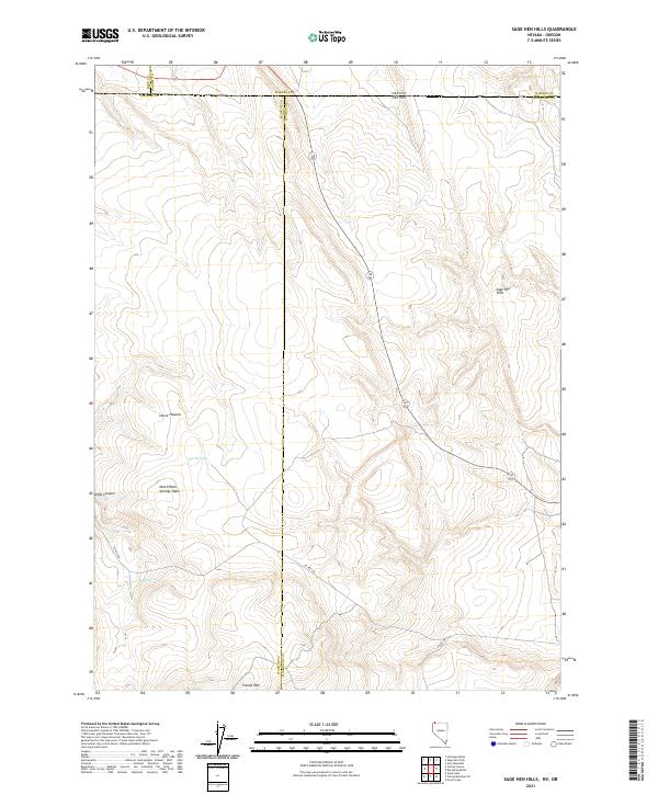
2021 Map of Sage Hen Hills
USGS Topo · Published 2021About this map
The high desert borderland where Nevada meets Oregon is defined by a series of prominent topographic features along the intersection of Humboldt, Washoe, Lake, and Harney counties. Centered on the Sage Hen Hills, the terrain rises toward the south at Catnip Mtn, providing a stark contrast to the surrounding canyon systems. To the west, Horse Heaven and the North Rock Springs Table overlook the high plateau, while North Lake and Rock Spring indicate the scarce but vital water sources in this arid landscape. The map illustrates a complex of historic administrative boundaries and early township divisions, such as t46n r23.5e, which guided early livestock and land management. Movement through this remote corridor is traced by the path of Co Rte 34a, connecting the region's scattered natural landmarks and seasonal grazing areas.
Find a feature on this map
23 named features on this map. Tap any name to fly to it.
Don’t see what you’re looking for? This feature index may not catch every label — zoom into the map to look around manually.
Map Details
Editions of this 2021 Sage Hen Hills Map
This is the sole edition of this map. No revisions or reprints were ever made.
Other maps of this area

1889 · Long Valley
USGS Topo · 1:250,000

1954 · Vya
USGS Topo · 1:250,000

1955 · Adel
USGS Topo · 1:250,000

1957 · Adel
USGS Topo · 1:250,000

1958 · Vya
USGS Topo · 1:250,000

1958 · Adel
USGS Topo · 1:250,000

1962 · Vya
USGS Topo · 1:250,000

1962 · Adel
USGS Topo · 1:250,000

1966 · Catnip Canyon
USGS Topo · 1:24,000

1966 · Swan Lake
USGS Topo · 1:24,000