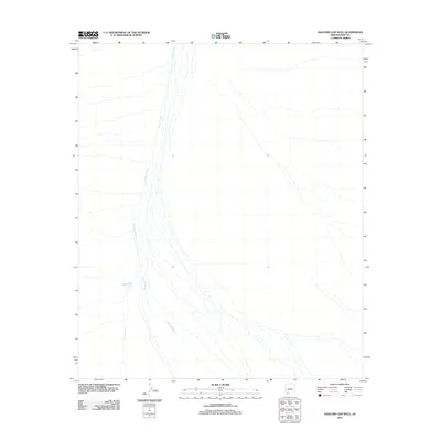
2011 Map of Saguaro Gap Well
USGS Topo · Published 2011About this map
Growler Wash dominates the arid drainage patterns of this Pima County landscape, its braided channels weaving across the desert floor. This 2011 survey focuses on a remote section of the Sonoran environment where the Saguaro Gap Well serves as a critical point of reference for local hydrology and land management. The sparse distribution of named features highlights the isolated character of the region, where the primary geological and historical interest lies in the movement of water through the seasonal washes and the human effort to tap into underground resources via scattered wells. The map captures a moment of modern topographic recording, detailing the subtle elevation changes and the network of dry stream beds that define the spatial organization of this desert territory.
Find a feature on this map
3 named features on this map. Tap any name to fly to it.
Don’t see what you’re looking for? This feature index may not catch every label — zoom into the map to look around manually.
Map Details
Editions of this 2011 Saguaro Gap Well Map
This is the sole edition of this map. No revisions or reprints were ever made.
Other maps of this area

1953 · Ajo
USGS Topo · 1:250,000

1957 · Ajo
USGS Topo · 1:250,000

1958 · Ajo
USGS Topo · 1:250,000

1962 · Ajo
USGS Topo · 1:250,000

1963 · Ajo
USGS Topo · 1:250,000

1964 · Growler Peak
USGS Topo · 1:62,500
1964 · Agua Dulce Mts
USGS Topo · 1:62,500

1965 · O'Neill Hills
USGS Topo · 1:62,500

1965 · Granite Mountains
USGS Topo · 1:62,500

1967 · Ajo
USGS Topo · 1:250,000