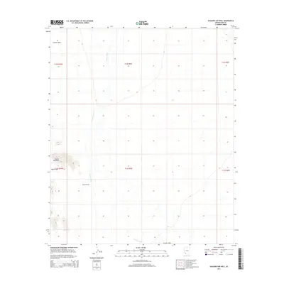
2014 Map of Saguaro Gap Well
USGS Topo · Published 2014About this map
Growler Wash meanders across the arid expanse of Growler Valley in this Pima County landscape, which is defined by the stark transition from flat desert floor to the steep rises of the Granite Mountains. The hydrology of the area is critically important, as evidenced by the isolated Saguaro Gap Well, a singular point of water infrastructure in a region dominated by ephemeral drainage patterns. This 2014 survey documents the topographic character of the Saguaro Gap, where the terrain creates a natural passage through the mountain range. The map provides a detailed view of the Public Land Survey System divisions, showing the grid of townships and ranges that impose a human order on this sparsely settled desert environment.
Find a feature on this map
11 named features on this map. Tap any name to fly to it.
Don’t see what you’re looking for? This feature index may not catch every label — zoom into the map to look around manually.
Map Details
Editions of this 2014 Saguaro Gap Well Map
This is the sole edition of this map. No revisions or reprints were ever made.
Other maps of this area

1953 · Ajo
USGS Topo · 1:250,000

1957 · Ajo
USGS Topo · 1:250,000

1958 · Ajo
USGS Topo · 1:250,000

1962 · Ajo
USGS Topo · 1:250,000

1963 · Ajo
USGS Topo · 1:250,000

1964 · Growler Peak
USGS Topo · 1:62,500
1964 · Agua Dulce Mts
USGS Topo · 1:62,500

1965 · O'Neill Hills
USGS Topo · 1:62,500

1965 · Granite Mountains
USGS Topo · 1:62,500

1967 · Ajo
USGS Topo · 1:250,000