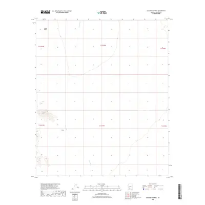
2018 Map of Saguaro Gap Well
USGS Topo · Published 2018About this map
Saguaro Gap Well serves as a critical water point in this arid stretch of Pima County, positioned where the desert floor meets the rising slopes of the Granite Mountains. The landscape is dominated by the broad expanse of Growler Valley, which is drained by the ephemeral Growler Wash as it flows north through the basin. This 2018 survey detail provides a clear look at the Public Land Survey System grid, including townships like t12s r9w and t13s r9w, illustrating how this remote corner of the Sonoran Desert is structured for land management and resource location despite its sparse development.
Find a feature on this map
10 named features on this map. Tap any name to fly to it.
Don’t see what you’re looking for? This feature index may not catch every label — zoom into the map to look around manually.
Map Details
Editions of this 2018 Saguaro Gap Well Map
This is the sole edition of this map. No revisions or reprints were ever made.
Other maps of this area

1953 · Ajo
USGS Topo · 1:250,000

1957 · Ajo
USGS Topo · 1:250,000

1958 · Ajo
USGS Topo · 1:250,000

1962 · Ajo
USGS Topo · 1:250,000

1963 · Ajo
USGS Topo · 1:250,000

1964 · Growler Peak
USGS Topo · 1:62,500
1964 · Agua Dulce Mts
USGS Topo · 1:62,500

1965 · O'Neill Hills
USGS Topo · 1:62,500

1965 · Granite Mountains
USGS Topo · 1:62,500

1967 · Ajo
USGS Topo · 1:250,000