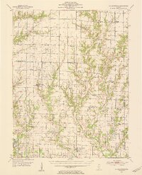
1953 Map of Sailor Springs
USGS Topo · Published 1955About this map
Louisville and the surrounding river bottomlands define the southwestern corner of this survey, where the Little Wabash River meets Ramsey Creek. The landscape transition from the well-drained heights of Bible Grove to the dense network of tributaries like Big Muddy Creek reveal a mid-century agricultural region heavily dotted with family-named landmarks and rural institutions. Significant local history value is found in the distribution of country schools and churches, including the Hoosier Prairie Ch and Conley Chapel, alongside numerous oil wells that signal the era's mineral production. The map also documents the decline of early educational infrastructure, marking several locations such as Union Sch and Kedron Sch as abandoned. Further east, the village of Sailor Springs and the settlement of Ingraham serve as local hubs for the surrounding farmsteads and cemeteries.
Find a feature on this map
78 named features on this map. Tap any name to fly to it.
Don’t see what you’re looking for? This feature index may not catch every label — zoom into the map to look around manually.
Map Details
Editions of this 1953 Sailor Springs Map
2 editions found

Other maps of this area

1940 · Greenup
USGS Topo · 1:62,500

1941 · Newton
USGS Topo · 1:62,500

1943 · Greenup
USGS Topo · 1:62,500

1943 · Newton
USGS Topo · 1:62,500

1948 · Flora
USGS Topo · 1:62,500

1949 · Olney
USGS Topo · 1:62,500

1949 · Flora
USGS Topo · 1:62,500

1950 · Effingham
USGS Topo · 1:62,500

1951 · Effingham
USGS Topo · 1:62,500

1952 · Xenia
USGS Topo · 1:62,500