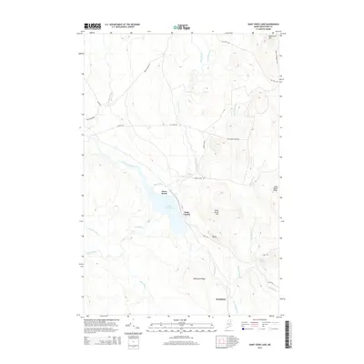
2014 Map of Saint Croix Lake
USGS Topo · Published 2014About this map
Saint Croix Lake sits at the heart of this North Woods landscape, where the waters of Saint Croix Stream and Howe Brook converge. The topography is defined by significant elevations, including Nighthawk Mtn and Black Cat Mountain in the northeast, and the prominent Weeksboro Ridge to the south. Small settlements like Howe Brook and Weeksboro are linked by a network of specialized roads such as Harvey Siding Rd and Boom Branch Rd, reflecting the region's historical ties to the timber industry.
Find a feature on this map
34 named features on this map. Tap any name to fly to it.
Don’t see what you’re looking for? This feature index may not catch every label — zoom into the map to look around manually.
Map Details
Editions of this 2014 Saint Croix Lake Map
This is the sole edition of this map. No revisions or reprints were ever made.
Other maps of this area

1935 · Howe Brook
USGS Topo · 1:48,000

1937 · Smyrna Mills
USGS Topo · 1:62,500

1939 · Howe Brook
USGS Topo · 1:62,500

1940 · Island Falls
USGS Topo · 1:62,500

1940 · Oxbow
USGS Topo · 1:62,500

1942 · Island Falls
USGS Topo · 1:62,500

1942 · Oxbow
USGS Topo · 1:62,500

1954 · Howe Brook
USGS Topo · 1:62,500

1954 · Presque Isle
USGS Topo · 1:250,000

1955 · Smyrna Mills
USGS Topo · 1:62,500
Featured Places
- Howe Brook, Saint Croix Township
- Weeksboro, Dudley Township
- Dudley Township, ME
- Webbertown Township, ME
- Saint Croix Township, ME