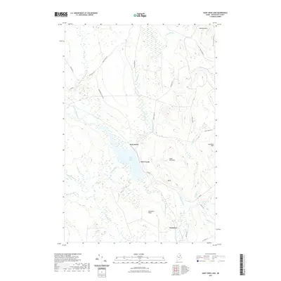
2021 Map of Saint Croix Lake
USGS Topo · Published 2021About this map
Howe Brook serves as the focal point of this northern Aroostook County landscape, situated along the northern shore of Saint Croix Lake. The settlement patterns here are defined by small outposts like Little Canada and Weeksboro, connected by a network of specialized routes such as Howe Brook Cut-Off Rd and St Croix Rd. This topography is characterized by a series of distinct peaks including Nighthawk Mtn, Howe Brook Mtn, and the high ground of Weeksboro Ridge, which channel numerous tributaries like Saint Croix Stream and Brandy Brook toward the central lake. The presence of features like Roll Dam Brook suggests a history of water management or logging infrastructure, while the concentration of seasonal and remote roads underscores the area's isolation and reliance on the land's natural hydrology and timber resources.
Find a feature on this map
36 named features on this map. Tap any name to fly to it.
Don’t see what you’re looking for? This feature index may not catch every label — zoom into the map to look around manually.
Map Details
Editions of this 2021 Saint Croix Lake Map
This is the sole edition of this map. No revisions or reprints were ever made.
Other maps of this area

1935 · Howe Brook
USGS Topo · 1:48,000

1937 · Smyrna Mills
USGS Topo · 1:62,500

1939 · Howe Brook
USGS Topo · 1:62,500

1940 · Island Falls
USGS Topo · 1:62,500

1940 · Oxbow
USGS Topo · 1:62,500

1942 · Island Falls
USGS Topo · 1:62,500

1942 · Oxbow
USGS Topo · 1:62,500

1954 · Howe Brook
USGS Topo · 1:62,500

1954 · Presque Isle
USGS Topo · 1:250,000

1955 · Smyrna Mills
USGS Topo · 1:62,500
Featured Places
- Howe Brook, Saint Croix Township
- Weeksboro, Dudley Township
- Dudley Township, ME
- Webbertown Township, ME
- Saint Croix Township, ME