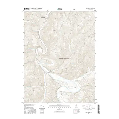
2016 Map of Saint George
USGS Topo · Published 2016About this map
The Cheat River carves a winding path through this portion of the Monongahela National Forest, defining the geography of Tucker County. Small riverside settlements like Saint George and Holly Meadows occupy the narrow flatlands, connected by the prominent Saint George Bridge. The map reveals a landscape of high ridges and deep hollows, such as Coon Hollow and Horseshoe Bend, where local life is anchored by family-named landmarks and upland cemeteries. Genealogical interest is concentrated in the numerous burial grounds scattered across the terrain, including Bethel Cem, Bonifield Cem, and Limestone Cem. Further north, the tiny community of Hannahsville sits near the confluence of Licking Cr, illustrating the historical reliance on watercourse junctions for early mountain habitation. These features, along with names like Mt Zion Ridge and Limestone Mtn, document a traditional West Virginia mountain community structure persisting into the 21st century.
Find a feature on this map
54 named features on this map. Tap any name to fly to it.
Don’t see what you’re looking for? This feature index may not catch every label — zoom into the map to look around manually.
Map Details
Editions of this 2016 Saint George Map
This is the sole edition of this map. No revisions or reprints were ever made.
Other maps of this area

1886 · St. George
USGS Topo · 1:125,000

1891 · St. George
USGS Topo · 1:125,000

1907 · Thornton
USGS Topo · 1:62,500

1907 · Kingwood
USGS Topo · 1:62,500

1907 · Belington
USGS Topo · 1:62,500

1908 · Parsons
USGS Topo · 1:62,500

1925 · Kingwood
USGS Topo · 1:62,500

1926 · Thornton
USGS Topo · 1:62,500

1926 · Parsons
USGS Topo · 1:62,500

1927 · Belington
USGS Topo · 1:62,500