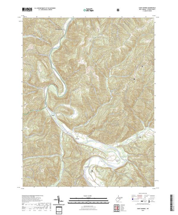
2023 Map of Saint George
USGS Topo · Published 2023About this map
St. George and the winding course of the Cheat River define this corner of Tucker County, where the river carves deep oxbows like Horseshoe Bend through the high country. Small riverfront settlements and agricultural pockets at Auvil and Holly Meadows occupy the narrow valley floors, shadowed by the steep rises of Limestone Mtn and Mount Zion Ridge. This area, much of which is within the Monongahela National Forest, maintains a rural character dominated by the drainage systems of Clover Run and Horseshoe Run. Genealogists will find several family and community burial grounds scattered across the high ridges and valley slopes, including the Bonnifield Cem near the river and Fairview Cem on the eastern heights. The map also traces the Upper Cheat River Water Trail, reflecting the river's central role in local recreation and geography.
Find a feature on this map
52 named features on this map. Tap any name to fly to it.
Don’t see what you’re looking for? This feature index may not catch every label — zoom into the map to look around manually.
Map Details
Editions of this 2023 Saint George Map
This is the sole edition of this map. No revisions or reprints were ever made.
Other maps of this area

1886 · St. George
USGS Topo · 1:125,000

1891 · St. George
USGS Topo · 1:125,000

1907 · Thornton
USGS Topo · 1:62,500

1907 · Kingwood
USGS Topo · 1:62,500

1907 · Belington
USGS Topo · 1:62,500

1908 · Parsons
USGS Topo · 1:62,500

1925 · Kingwood
USGS Topo · 1:62,500

1926 · Thornton
USGS Topo · 1:62,500

1926 · Parsons
USGS Topo · 1:62,500

1927 · Belington
USGS Topo · 1:62,500