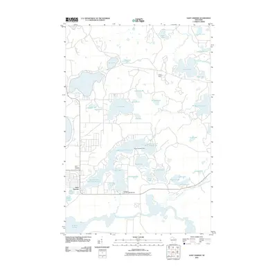
2010 Map of Saint Germain
USGS Topo · Published 2010About this map
Saint Germain serves as the central hub of this lake-strewn landscape in Oneida County, where the network of glacial water bodies defines local geography and development. The settlement, situated near the western shores of Little Saint Germain Lake, is anchored by the Saint Germain Cemetery and the engineering of the Little Saint Germain-1909C361 Dam. This 2010 depiction illustrates the density of seasonal and year-round housing clustered around prominent basins like Found Lake, Moon Lake, and Muskellunge Lake.
Find a feature on this map
45 named features on this map. Tap any name to fly to it.
Don’t see what you’re looking for? This feature index may not catch every label — zoom into the map to look around manually.
Map Details
Editions of this 2010 Saint Germain Map
This is the sole edition of this map. No revisions or reprints were ever made.
Other maps of this area

1930 · Robbins
USGS Topo · 1:48,000

1938 · Minocqua
USGS Topo · 1:48,000

1938 · Robbins
USGS Topo · 1:48,000

1939 · Trout Lake
USGS Topo · 1:48,000

1945 · Robbins
USGS Topo · 1:48,000

1946 · Star Lake
USGS Topo · 1:48,000

1946 · Minocqua
USGS Topo · 1:48,000

1946 · Trout Lake
USGS Topo · 1:48,000

1949 · Trout Lake
USGS Topo · 1:48,000

1949 · Minocqua
USGS Topo · 1:48,000