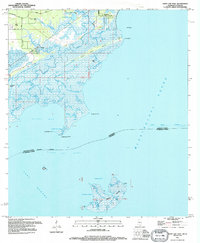
1994 Map of Saint Joe Pass
USGS Topo · Published 1995About this map
The low-lying coastal marshes and intricate tidal bayous of the Mississippi-Louisiana border dominate this 1994 survey. Centered on the boundary between Hancock County and St. Bernard Parish, the landscape is defined by the complex aquatic networks of Bayou Caddy, Heron Bay Bayou, and Turkey Bayou. Small coastal settlements like Ansley and Lakeshore are tucked along the northern edge of the map, connected by Lower Bay Road. The geography transitions from these fringe communities into the open waters of Saint Joe Pass and Mississippi Sound. To the south, isolated landforms such as the marshy Half Moon Island sit within Lake Borgne, featuring distinctive points like Pokey Dutch and Gamblers Bend. This map captures the coastal environment before significant modern changes, preserving the locations of numerous unnamed lighthouse foundations and daybeacons that once guided marine traffic through these difficult shallows.
Find a feature on this map
40 named features on this map. Tap any name to fly to it.
Don’t see what you’re looking for? This feature index may not catch every label — zoom into the map to look around manually.
Map Details
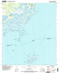
Editions of this 1994 Saint Joe Pass Map
2 editions found
Other maps of this area

1893 · Rigolets
USGS Topo · 1:62,500

1893 · Toulme
USGS Topo · 1:62,500

1914 · Nicholson
USGS Topo · 1:62,500

1921 · Nicholson
USGS Topo · 1:62,500

1935 · English Lookout
USGS Topo · 1:31,680

1935 · Grand Island Pass
USGS Topo · 1:31,680

1936 · Rigolets
USGS Topo · 1:62,500

1946 · Malheureux Point
USGS Topo · 1:31,680

1949 · Grand Island Pass
USGS Topo · 1:31,680
1949 · False Mouth Bayou
USGS Topo · 1:31,680