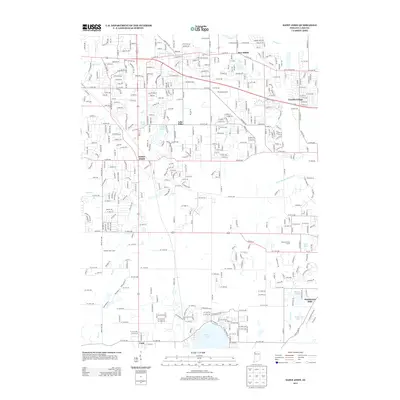
2013 Map of Saint John
USGS Topo · Published 2013About this map
Saint John and its surrounding suburban developments characterize this Lake County landscape during a period of significant residential expansion. The map detail highlights the integration of residential neighborhoods with recreational spaces, notably the Palmira Golf Course and Oak Knoll Golf Course. Smaller communities such as New Elliott and Lincoln Village are situated near major arteries like Old Lincoln Hwy, while the southern portion of the sheet shows the northern edge of Cedar Lake. Water management is a defining feature of the area, as evidenced by a network of drainage systems including Main Beaver Dam Ditch, Schererville Ditch, and Dyer Ditch. This intricate hydrological network supports the residential pockets and golf courses that have come to define the terrain between the established settlements of Cook and Hawthorne Hills.
Find a feature on this map
77 named features on this map. Tap any name to fly to it.
Don’t see what you’re looking for? This feature index may not catch every label — zoom into the map to look around manually.
Map Details
Editions of this 2013 Saint John Map
This is the sole edition of this map. No revisions or reprints were ever made.
Other maps of this area

1892 · Calumet
USGS Topo · 1:62,500

1893 · Calumet
USGS Topo · 1:62,500

1900 · Toleston
USGS Topo · 1:62,500

1900 · Calumet
USGS Topo · 1:62,500

1901 · Calumet
USGS Topo · 1:62,500

1929 · Calumet City
USGS Topo · 1:24,000

1929 · Dyer
USGS Topo · 1:24,000

1930 · Dyer
USGS Topo · 1:24,000

1949 · Crete
USGS Topo · 1:62,500

1953 · Leroy
USGS Topo · 1:24,000