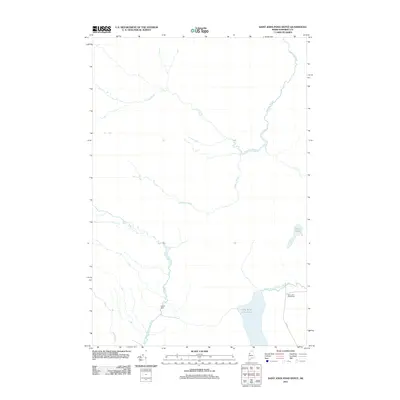
2011 Map of Saint John Pond Depot
USGS Topo · Published 2011About this map
Fifth Saint John Pond and the surrounding woodlands of Somerset County define this remote landscape at the headwaters of two major river systems. The map illustrates a critical hydrologic divide where the North Branch Penobscot River flows south while the Baker Branch Saint John River begins its northward journey. Historically, this area served as a remote outpost for logging operations, evidenced by the Saint John Pond Depot located on the eastern shore of the pond. A network of smaller waterways including Sweeney Brook, Carry Brook, and Prouty Brook feed into these larger systems, tracing the natural drainage patterns of the Maine woods. Man-made interventions are sparse, limited to the Lower Dam and the logging route designated as 480 Rd, reflecting the region's enduring character as a managed timberland and wilderness area.
Find a feature on this map
10 named features on this map. Tap any name to fly to it.
Don’t see what you’re looking for? This feature index may not catch every label — zoom into the map to look around manually.
Map Details
Editions of this 2011 Saint John Pond Depot Map
This is the sole edition of this map. No revisions or reprints were ever made.
Other maps of this area

1954 · Baker Lake
USGS Topo · 1:62,500

1954 · St. John Pond
USGS Topo · 1:62,500

1954 · Presque Isle
USGS Topo · 1:250,000

1957 · Norris Brook
USGS Topo · 1:62,500

1957 · Hardwood Mountain
USGS Topo · 1:62,500

1958 · Presque Isle
USGS Topo · 1:250,000

1958 · Saint John Pond
USGS Topo · 1:62,500

1960 · Presque Isle
USGS Topo · 1:250,000

1962 · Baker Lake
USGS Topo · 1:62,500

1962 · Quebec
USGS Topo · 1:250,000