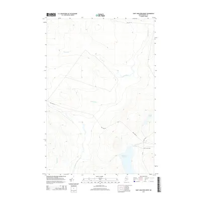
2014 Map of Saint John Pond Depot
USGS Topo · Published 2014About this map
The North Branch Penobscot River and the Baker Branch Saint John River flow from this remote section of the Maine North Woods, representing a critical watershed divide where waters part toward the Penobscot and Saint John basins. This 2014 survey documents the industrial and recreational access routes of Somerset County, centering on the Saint John Pond Depot near the shores of Fifth Saint John Pond. The landscape is defined by an intricate network of drainage, including Carry Brook, Sweeney Brook, and Prouty Brook, which navigate the high-elevation terrain. Private timberlands are accessed by established thoroughfares such as Baker Lake Rd and Braily Brook Rd, showing the modern infrastructure required for land management and remote outpost maintenance in one of the most sparsely populated regions of the state.
Find a feature on this map
10 named features on this map. Tap any name to fly to it.
Don’t see what you’re looking for? This feature index may not catch every label — zoom into the map to look around manually.
Map Details
Editions of this 2014 Saint John Pond Depot Map
This is the sole edition of this map. No revisions or reprints were ever made.
Other maps of this area

1954 · Baker Lake
USGS Topo · 1:62,500

1954 · St. John Pond
USGS Topo · 1:62,500

1954 · Presque Isle
USGS Topo · 1:250,000

1957 · Norris Brook
USGS Topo · 1:62,500

1957 · Hardwood Mountain
USGS Topo · 1:62,500

1958 · Presque Isle
USGS Topo · 1:250,000

1958 · Saint John Pond
USGS Topo · 1:62,500

1960 · Presque Isle
USGS Topo · 1:250,000

1962 · Baker Lake
USGS Topo · 1:62,500

1962 · Quebec
USGS Topo · 1:250,000