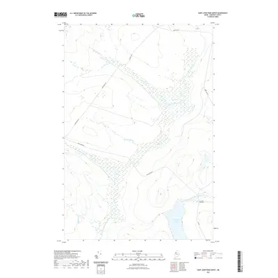
2021 Map of Saint John Pond Depot
USGS Topo · Published 2021About this map
Saint John Pond Depot marks a lonely outpost in the deep woods of Somerset County, where the hydrological divide of northern Maine is clearly visible. The landscape is defined by the headwaters of two major systems: the Baker Branch Saint John River flowing north through Fifth Saint John Pond and the North Branch Penobscot River draining the southern portion of the quadrangle. This interior wilderness is characterized by extensive wetland complexes, including Sweeney Bog and Little Bog, which act as natural reservoirs for the many tributaries here. A network of logging roads, such as Baker Lake Rd and Braily Brook Rd, provides the only overland access through the dense forest. The map documents the persistent importance of water-based geography in this region, where Carry Brook and Sweeney Brook carve paths through the timberlands toward the larger river basins.
Find a feature on this map
14 named features on this map. Tap any name to fly to it.
Don’t see what you’re looking for? This feature index may not catch every label — zoom into the map to look around manually.
Map Details
Editions of this 2021 Saint John Pond Depot Map
This is the sole edition of this map. No revisions or reprints were ever made.
Other maps of this area

1954 · Baker Lake
USGS Topo · 1:62,500

1954 · St. John Pond
USGS Topo · 1:62,500

1954 · Presque Isle
USGS Topo · 1:250,000

1957 · Norris Brook
USGS Topo · 1:62,500

1957 · Hardwood Mountain
USGS Topo · 1:62,500

1958 · Presque Isle
USGS Topo · 1:250,000

1958 · Saint John Pond
USGS Topo · 1:62,500

1960 · Presque Isle
USGS Topo · 1:250,000

1962 · Baker Lake
USGS Topo · 1:62,500

1962 · Quebec
USGS Topo · 1:250,000