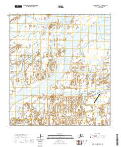
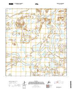
2020 Map of Saint Michael A-4 SE
USGS Topo · Published 2020About this map
Kotlik serves as the focal point of this delta landscape, positioned at the convergence of the Kotlik River and Apoon Pass. This 2020 survey illustrates the intricate aqueous geography of the Yukon-Kuskokwim Delta, where the land is fragmented by a complex network of waterways including Okwega Pass, Kwichlowak Pass, and Kanunuk Slough. The settlement's connection to the wider region is anchored by the Kotlik Airport and its accompanying Airport Road, vital infrastructure in a terrain dominated by wetlands and shifting channels.
Find a feature on this map
25 named features on this map. Tap any name to fly to it.
Don’t see what you’re looking for? This feature index may not catch every label — zoom into the map to look around manually.
Map Details
Editions of this 2020 Saint Michael A-4 SE Map
This is the sole edition of this map. No revisions or reprints were ever made.
Other maps of this area

1951 · St Michael
USGS Topo · 1:250,000

1952 · Kwiguk
USGS Topo · 1:250,000
1952 · Saint Michael A-4
USGS Topo · 1:63,360

1952 · Kwiguk D-3
USGS Topo · 1:63,360
1952 · Saint Michael A-3
USGS Topo · 1:63,360

1952 · Kwiguk D-4
USGS Topo · 1:63,360

1952 · St Michael
USGS Topo · 1:250,000

1964 · St. Michael
USGS Topo · 1:250,000
2020 · Kwiguk D-4 NE
USGS Topo · 1:25,000
2020 · Kwiguk D-4 NW
USGS Topo · 1:25,000