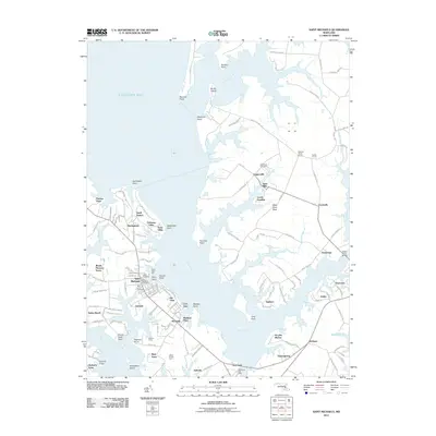
2011 Map of Saint Michaels
USGS Topo · Published 2011About this map
Saint Michaels anchors this maritime landscape where the Miles River meets the Eastern Bay, revealing a pattern of coastal development and historic landings. The town's historic core, marked by the Saint Michaels Post Office and Saint Lukes Cemetery, is complemented by waterfront features like the Navy Point Pier and the local Yacht Club. Moving inland, the survey shows a network of named farms and small communities such as Unionville, Tunis Mills, and Copperville, connected by narrow roads like Mount Misery Rd and Copperville Rd. The geography is defined by numerous points and necks, including Hambleton Point and Miles River Neck, reflecting the complex shoreline of the Chesapeake's Eastern Shore. This map provides a detailed view of the area's transition from traditional agricultural lands, like Beverly Farm and Mount Pleasant Farms, to contemporary residential clusters like Rio Vista and Gullwing Villas.
Find a feature on this map
102 named features on this map. Tap any name to fly to it.
Don’t see what you’re looking for? This feature index may not catch every label — zoom into the map to look around manually.
Map Details
Editions of this 2011 Saint Michaels Map
This is the sole edition of this map. No revisions or reprints were ever made.
Other maps of this area

1892 · Annapolis
USGS Topo · 1:62,500

1893 · Sharps Island
USGS Topo · 1:62,500

1898 · Choptank
USGS Topo · 1:125,000

1904 · St. Michaels
USGS Topo · 1:62,500

1904 · Annapolis
USGS Topo · 1:62,500

1904 · Sharps Island
USGS Topo · 1:62,500

1904 · Oxford
USGS Topo · 1:62,500

1908 · Choptank
USGS Topo · 1:125,000

1942 · Tilghman
USGS Topo · 1:31,680

1942 · Oxford
USGS Topo · 1:31,680