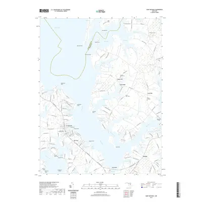
2019 Map of Saint Michaels
USGS Topo · Published 2019About this map
St. Michaels anchors this detailed look at the Eastern Shore's intricate waterfront, where the Miles River and Broad Creek carve out numerous necks and coves. The settlement pattern reflects deep roots in maritime and agricultural history, visible in the cluster of small communities like Tunis Mills, Unionville, and Copperville. Genealogical details are well-preserved through sites like Saint Stephens Graveyard and Saint Lukes Methodist Cem, while the location of Navy Point marks the town's traditional center of maritime trade. The landscape is defined by the proximity of water to every homestead, with named points such as Bennett Point and Fairview Point framing the many bays. Inland, the road network connects historic landings to crossroads like Kirkham and Newcomb, illustrating the enduring transit corridors of Talbot County.
Find a feature on this map
149 named features on this map. Tap any name to fly to it.
Don’t see what you’re looking for? This feature index may not catch every label — zoom into the map to look around manually.
Map Details
Editions of this 2019 Saint Michaels Map
This is the sole edition of this map. No revisions or reprints were ever made.
Other maps of this area

1892 · Annapolis
USGS Topo · 1:62,500

1893 · Sharps Island
USGS Topo · 1:62,500

1898 · Choptank
USGS Topo · 1:125,000

1904 · St. Michaels
USGS Topo · 1:62,500

1904 · Annapolis
USGS Topo · 1:62,500

1904 · Sharps Island
USGS Topo · 1:62,500

1904 · Oxford
USGS Topo · 1:62,500

1908 · Choptank
USGS Topo · 1:125,000

1942 · Tilghman
USGS Topo · 1:31,680

1942 · Oxford
USGS Topo · 1:31,680