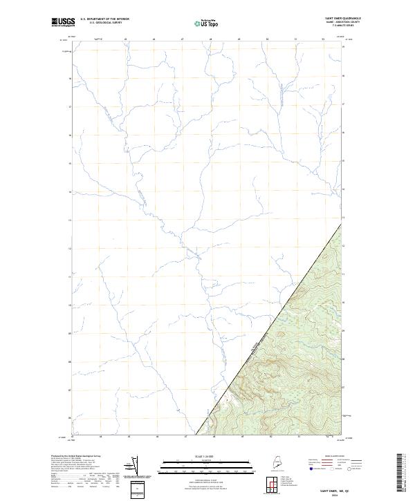
2024 Map of Saint Omer
USGS Topo · Published 2024About this map
The international boundary between the United States and Canada cuts diagonally across this remote landscape in Aroostook County, Maine. The terrain is defined by the headwaters of several significant waterways, including the winding course of the Rivière du Rochu and the Rivière des Cinq Milles, which drain the northern Maine woods into the Saint John River basin. This survey illustrates the densely forested borderlands where the Little Saint Roch River flows south across the frontier. The geography here is almost entirely dominated by natural drainage patterns and the historic demarcation of the border, with very few signs of human development or infrastructure beyond the surveying lines that define the geopolitical edge of the northern United States.
Find a feature on this map
4 named features on this map. Tap any name to fly to it.
Don’t see what you’re looking for? This feature index may not catch every label — zoom into the map to look around manually.
Map Details
Editions of this 2024 Saint Omer Map
This is the sole edition of this map. No revisions or reprints were ever made.
Other maps of this area

1954 · Presque Isle
USGS Topo · 1:250,000

1955 · Little East Lake
USGS Topo · 1:62,500

1955 · Depot Lake
USGS Topo · 1:62,500

1955 · Seven Islands
USGS Topo · 1:62,500

1958 · Presque Isle
USGS Topo · 1:250,000

1960 · Presque Isle
USGS Topo · 1:250,000

1962 · Edmundston
USGS Topo · 1:250,000

1976 · East Lake
USGS Topo · 1:24,000

1976 · East Lake SE
USGS Topo · 1:24,000
1976 · St. Pamphile
USGS Topo · 1:24,000