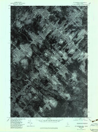
1976 Map of St. Pamphile
USGS Topo · Published 1983About this map
St Pamphile straddles the international border in this 1976 orthophotoquad, showing a landscape defined by the distinct long-lot land divisions characteristic of Quebec’s seigneurial system. Unlike the standard grid patterns found in much of the United States, these narrow, elongated parcels radiate from the central settlement and roads, optimizing access to transportation routes and water. The terrain is marked by the winding course of the Black River at the bottom of the sheet, joined by Good Brook. This aerial perspective provides an unfiltered look at the intersection of forest management and agriculture along the Maine-Quebec border, capturing the density of structures in the village center and the intricate network of farm lanes extending into the surrounding timberlands.
Find a feature on this map
3 named features on this map. Tap any name to fly to it.
Don’t see what you’re looking for? This feature index may not catch every label — zoom into the map to look around manually.
Map Details
Editions of this 1976 St. Pamphile Map
This is the sole edition of this map. No revisions or reprints were ever made.
Other maps of this area

1954 · Presque Isle
USGS Topo · 1:250,000

1955 · Little East Lake
USGS Topo · 1:62,500

1955 · Depot Lake
USGS Topo · 1:62,500

1955 · Seven Islands
USGS Topo · 1:62,500

1958 · Presque Isle
USGS Topo · 1:250,000

1960 · Presque Isle
USGS Topo · 1:250,000

1962 · Edmundston
USGS Topo · 1:250,000

1976 · Depot Lake
USGS Topo · 1:24,000
1977 · St. Adalbert
USGS Topo · 1:24,000
1977 · Charles Pond
USGS Topo · 1:24,000