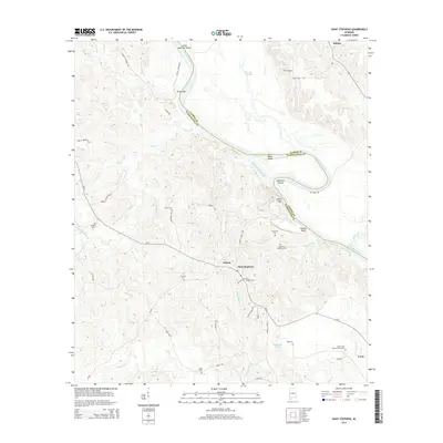
2014 Map of Saint Stephens
USGS Topo · Published 2014About this map
The Tombigbee River snakes through the border of Clarke and Washington counties, anchoring a landscape where Alabama's early territorial history remains visible through its numerous burial grounds. Near the settlement of Saint Stephens, the river topography includes notable landmarks like Lovers Leap and Cowans Bluff, while the inland area is marked by a network of creek drainages including Tauler Cr and Gordy Mill Cr. This region, central to the state's foundation, is dotted with genealogical waypoints such as Old Saint Stephens Cem and Mt Nebo Cem. The terrain south toward Leroy and Wilson transitions into a dense web of local roads and watercourses like Bassetts Cr, reflecting a rural community deeply tied to the river's path and the surrounding timber and agriculture lands. A significant industrial presence is noted via the Cement Plant Rd, illustrating the intersection of natural resources and local infrastructure.
Find a feature on this map
61 named features on this map. Tap any name to fly to it.
Don’t see what you’re looking for? This feature index may not catch every label — zoom into the map to look around manually.
Map Details
Editions of this 2014 Saint Stephens Map
This is the sole edition of this map. No revisions or reprints were ever made.
Other maps of this area

1943 · Choctaw Bluff
USGS Topo · 1:62,500

1943 · McIntosh
USGS Topo · 1:62,500

1944 · McIntosh
USGS Topo · 1:62,500

1946 · Choctaw Bluff
USGS Topo · 1:62,500

1953 · Andalusia
USGS Topo · 1:250,000

1953 · Hattiesburg
USGS Topo · 1:250,000

1957 · Andalusia
USGS Topo · 1:250,000

1958 · Hattiesburg
USGS Topo · 1:250,000

1971 · Bigbee
USGS Topo · 1:24,000

1971 · Bladon Springs
USGS Topo · 1:24,000