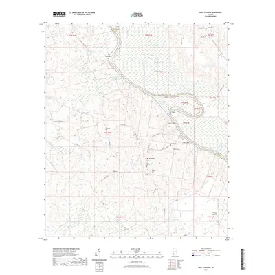
2020 Map of Saint Stephens
USGS Topo · Published 2020About this map
The Tombigbee River carves a winding path through this region of Washington and Clarke Counties, defining a landscape of wetlands and navigational challenges like Little McGrews Shoals and Baker Shoals. The town of St. Stephens serves as a primary hub, surrounded by deep-rooted local history evident in its numerous burial grounds, including the Old Saint Stephens Cem and Saint Stephens Cem. The river's influence is seen in features like Old Lock One Cut Off and the bluffs at Lovers Leap and Cowans Bluff.
Find a feature on this map
65 named features on this map. Tap any name to fly to it.
Don’t see what you’re looking for? This feature index may not catch every label — zoom into the map to look around manually.
Map Details
Editions of this 2020 Saint Stephens Map
This is the sole edition of this map. No revisions or reprints were ever made.
Other maps of this area

1943 · Choctaw Bluff
USGS Topo · 1:62,500

1943 · McIntosh
USGS Topo · 1:62,500

1944 · McIntosh
USGS Topo · 1:62,500

1946 · Choctaw Bluff
USGS Topo · 1:62,500

1953 · Andalusia
USGS Topo · 1:250,000

1953 · Hattiesburg
USGS Topo · 1:250,000

1957 · Andalusia
USGS Topo · 1:250,000

1958 · Hattiesburg
USGS Topo · 1:250,000

1971 · Bigbee
USGS Topo · 1:24,000

1971 · Bladon Springs
USGS Topo · 1:24,000