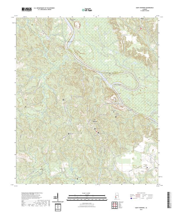
2024 Map of Saint Stephens
USGS Topo · Published 2024About this map
The Tombigbee River carves a winding path through this corner of the Alabama coastal plain, marking the border between Clarke and Washington Counties. Near the center of the map, the historic riverside settlement of St. Stephens stands as a focal point, surrounded by a high density of burial grounds including the Old Saint Stephens Cem and the nearby Saint Stephens Cem. The landscape is defined by the river’s historical navigation features and natural landmarks, from the sharp bend at Lovers Leap and Cowans Bluff to the remains of waterway engineering at the Old Lock One Cut-Off. To the south, the terrain transitions into the Wilderness Swamp near the community of Leroy, where the Saint Union - Mount Stoney Cem provides a significant touchstone for genealogical research. Local industry is hinted at by the Cement Plant Rd leading toward the riverbanks, while numerous small family and community cemeteries like Crawford Cem and Mount Nebo Cem are scattered across the interior uplands.
Find a feature on this map
121 named features on this map. Tap any name to fly to it.
Don’t see what you’re looking for? This feature index may not catch every label — zoom into the map to look around manually.
Map Details
Editions of this 2024 Saint Stephens Map
This is the sole edition of this map. No revisions or reprints were ever made.
Other maps of this area

1943 · Choctaw Bluff
USGS Topo · 1:62,500

1943 · McIntosh
USGS Topo · 1:62,500

1944 · McIntosh
USGS Topo · 1:62,500

1946 · Choctaw Bluff
USGS Topo · 1:62,500

1953 · Andalusia
USGS Topo · 1:250,000

1953 · Hattiesburg
USGS Topo · 1:250,000

1957 · Andalusia
USGS Topo · 1:250,000

1958 · Hattiesburg
USGS Topo · 1:250,000

1971 · Bigbee
USGS Topo · 1:24,000

1971 · Bladon Springs
USGS Topo · 1:24,000