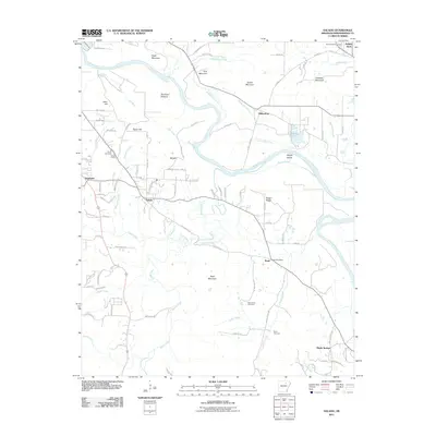
2011 Map of Salado
USGS Topo · Published 2011About this map
The White River winds through this section of Independence County, carving out the expansive Dennison Bottoms and creating distinct landforms like Wright Island and Wright Cutoff. The landscape is defined by the sharp transition from these low-lying river bottoms to prominent elevations such as Eagle Mountain, Pine Mountain, and Neal Mountain. The community of Salado serves as a central point for a network of creeks including Salado Creek and Caneu Creek, while the settlement of Rosie is anchored by the Rosie Post Office.
Find a feature on this map
108 named features on this map. Tap any name to fly to it.
Don’t see what you’re looking for? This feature index may not catch every label — zoom into the map to look around manually.
Map Details
Editions of this 2011 Salado Map
This is the sole edition of this map. No revisions or reprints were ever made.
Other maps of this area

1890 · Batesville
USGS Topo · 1:125,000

1891 · Batesville
USGS Topo · 1:125,000

1932 · Strawberry
USGS Topo · 1:62,500

1935 · Strawberry
USGS Topo · 1:62,500

1935 · Newport
USGS Topo · 1:62,500

1941 · Strawberry
USGS Topo · 1:62,500

1942 · Jamestown
USGS Topo · 1:31,680

1942 · Salado
USGS Topo · 1:31,680

1942 · Batesville
USGS Topo · 1:31,680

1943 · Sulphur Rock
USGS Topo · 1:31,680