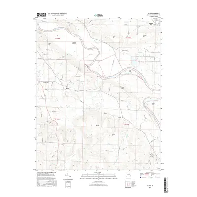
2017 Map of Salado
USGS Topo · Published 2017About this map
The White River carves a serpentine path through this portion of Independence County, creating a landscape of fertile lowlands like Dennison Bottoms and prominent heights such as Eagle Mtn and Neal Mtn. The river's historical influence on the topography is evident in features like Wright Island and Padgett Island, along with the Wright Cutoff and the winding Old River channel. Settlement patterns are anchored by the communities of Sulphur Rock, Salado, and Southside, with smaller localities like Rosie and Maple Springs serving as local landmarks.
Find a feature on this map
104 named features on this map. Tap any name to fly to it.
Don’t see what you’re looking for? This feature index may not catch every label — zoom into the map to look around manually.
Map Details
Editions of this 2017 Salado Map
This is the sole edition of this map. No revisions or reprints were ever made.
Other maps of this area

1890 · Batesville
USGS Topo · 1:125,000

1891 · Batesville
USGS Topo · 1:125,000

1932 · Strawberry
USGS Topo · 1:62,500

1935 · Strawberry
USGS Topo · 1:62,500

1935 · Newport
USGS Topo · 1:62,500

1941 · Strawberry
USGS Topo · 1:62,500

1942 · Jamestown
USGS Topo · 1:31,680

1942 · Salado
USGS Topo · 1:31,680

1942 · Batesville
USGS Topo · 1:31,680

1943 · Sulphur Rock
USGS Topo · 1:31,680