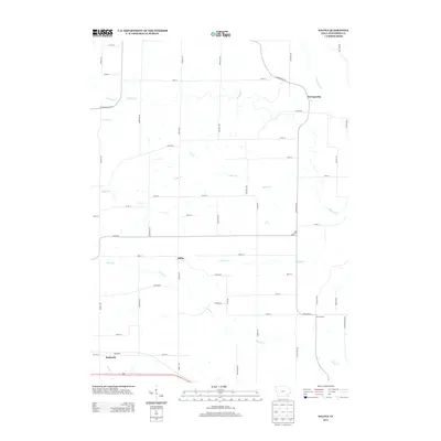
2013 Map of Salina
USGS Topo · Published 2013About this map
Germanville and Salina anchor this agrarian landscape in Jefferson County, reflecting a rural Iowa settlement pattern defined by small unincorporated communities and a dense network of country roads. The terrain is intricately carved by numerous waterways including Burr Oak Cr, Turkey Cr, and the various branches of Walnut Cr. The map reveals the persistence of late-19th-century place names such as Beckwith in the south and Four Corners in the east, which remain as identifiers for local residents even as the physical centers of these hamlets have evolved. The landscape is primarily organized by the section lines of the Public Land Survey System, evidenced by the grid of thoroughfares like Germanville Rd and Salina Rd that bypass the natural contours of Rocky Br and Brush Cr.
Find a feature on this map
53 named features on this map. Tap any name to fly to it.
Don’t see what you’re looking for? This feature index may not catch every label — zoom into the map to look around manually.
Map Details
Editions of this 2013 Salina Map
This is the sole edition of this map. No revisions or reprints were ever made.
Other maps of this area

1958 · Burlington
USGS Topo · 1:250,000

1958 · Davenport
USGS Topo · 1:250,000

1961 · Burlington
USGS Topo · 1:250,000

1961 · Davenport
USGS Topo · 1:250,000

1962 · Davenport
USGS Topo · 1:250,000

1963 · Burlington
USGS Topo · 1:250,000
1980 · Fairfield North
USGS Topo · 1:24,000
1980 · Richland
USGS Topo · 1:24,000

1980 · Brighton
USGS Topo · 1:24,000
1980 · Fairfield South
USGS Topo · 1:24,000