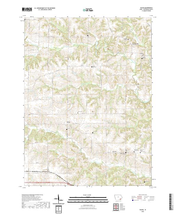
2022 Map of Salina
USGS Topo · Published 2022About this map
Germanville and Salina anchor this portrait of Jefferson County, where the rural landscape is defined by its deep religious and ethnic roots. The map reveals a dense network of country graveyards, such as the Polishville Cem and Saints Peter and Paul Catholic Cem, reflecting the early Central and Eastern European immigrant settlements in the region. The southeastern corner is particularly concentrated with faith-based landmarks, including the New Sweden Baptist Cem, New Sweden Cem, and the Four Corners German Lutheran Cem. These sites, along with smaller family or community plots like Chilcott Cem and Courtney Cem, provide a precise spatial record for genealogical research. The terrain is bisected by numerous waterways including Walnut Creek, Turkey Cr, and Brush Cr, which shaped the early township roads and property boundaries of this agricultural corridor.
Find a feature on this map
56 named features on this map. Tap any name to fly to it.
Don’t see what you’re looking for? This feature index may not catch every label — zoom into the map to look around manually.
Map Details
Editions of this 2022 Salina Map
This is the sole edition of this map. No revisions or reprints were ever made.
Other maps of this area

1958 · Burlington
USGS Topo · 1:250,000

1958 · Davenport
USGS Topo · 1:250,000

1961 · Burlington
USGS Topo · 1:250,000

1961 · Davenport
USGS Topo · 1:250,000

1962 · Davenport
USGS Topo · 1:250,000

1963 · Burlington
USGS Topo · 1:250,000
1980 · Fairfield North
USGS Topo · 1:24,000
1980 · Richland
USGS Topo · 1:24,000

1980 · Brighton
USGS Topo · 1:24,000
1980 · Fairfield South
USGS Topo · 1:24,000