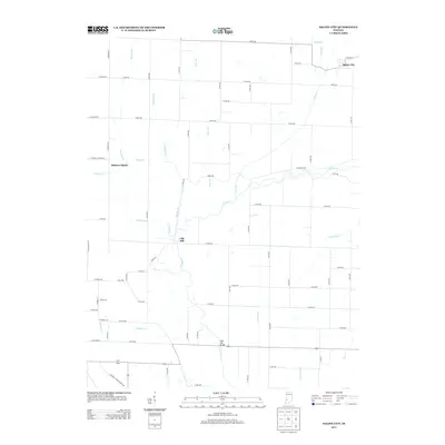
2013 Map of Saline City
USGS Topo · Published 2013About this map
Saline City sits at the northeastern corner of this Clay County landscape, where the flat agricultural terrain is defined by an intricate network of drainage and river systems. The Eel River snakes through the center of the quadrangle, flanked by low-lying features such as Hickory Island and Old Hill. The prevalence of named drainage channels like Conneley Ditch and Lafferty Ditch, alongside natural waterways like Big Slough and Birch Cr, illustrates a century-long effort to manage the wet bottomlands for cultivation. A notable landmark in the southern reaches is the Neal Mill Bridge, carrying local traffic over the river. The presence of W Towpath Rd following the river's curve provides a trace of the historical transportation corridors that once moved goods through this river valley.
Find a feature on this map
60 named features on this map. Tap any name to fly to it.
Don’t see what you’re looking for? This feature index may not catch every label — zoom into the map to look around manually.
Map Details
Editions of this 2013 Saline City Map
This is the sole edition of this map. No revisions or reprints were ever made.
Other maps of this area

1908 · Clay City
USGS Topo · 1:48,000

1910 · Clay City
USGS Topo · 1:62,500

1938 · Coal City
USGS Topo · 1:24,000

1940 · Lewis
USGS Topo · 1:24,000

1940 · Jasonville
USGS Topo · 1:24,000

1941 · Seelyville
USGS Topo · 1:24,000

1943 · Hymera
USGS Topo · 1:24,000

1948 · Coal City
USGS Topo · 1:24,000
1952 · Lewis
USGS Topo · 1:24,000

1952 · Seelyville
USGS Topo · 1:24,000