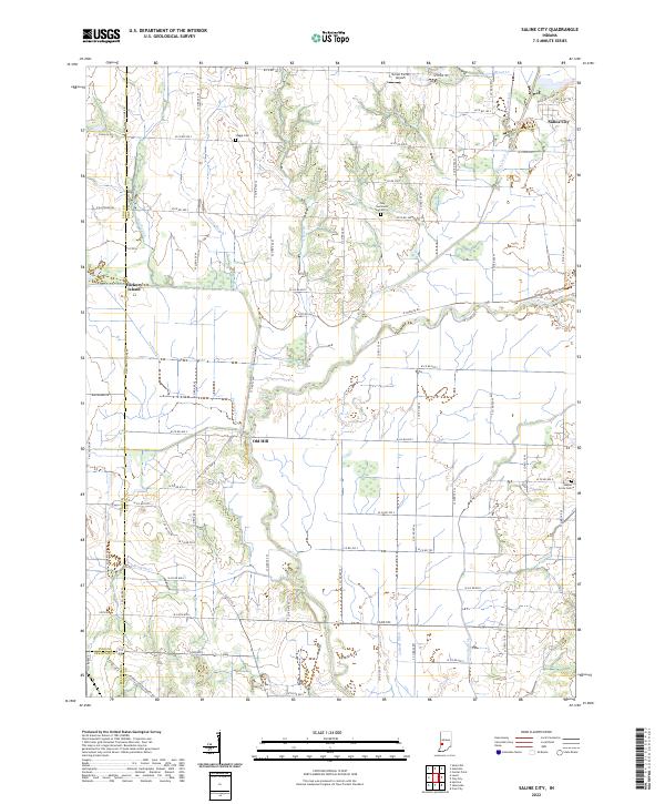
2022 Map of Saline City
USGS Topo · Published 2022About this map
The Eel River and its complex network of tributaries, including Birch Creek and Splunge Creek, define the topography of this section of Clay County. The settlement of Saline City sits in the northeast corner, situated near where Crooked Cr meets the larger river system. This area is characterized by low-lying drainage features like Lafferty Ditch and Conneley Ditch, which suggest a long history of water management to support local agriculture.
Find a feature on this map
78 named features on this map. Tap any name to fly to it.
Don’t see what you’re looking for? This feature index may not catch every label — zoom into the map to look around manually.
Map Details
Editions of this 2022 Saline City Map
This is the sole edition of this map. No revisions or reprints were ever made.
Other maps of this area

1908 · Clay City
USGS Topo · 1:48,000

1910 · Clay City
USGS Topo · 1:62,500

1938 · Coal City
USGS Topo · 1:24,000

1940 · Lewis
USGS Topo · 1:24,000

1940 · Jasonville
USGS Topo · 1:24,000

1941 · Seelyville
USGS Topo · 1:24,000

1943 · Hymera
USGS Topo · 1:24,000

1948 · Coal City
USGS Topo · 1:24,000
1952 · Lewis
USGS Topo · 1:24,000

1952 · Seelyville
USGS Topo · 1:24,000