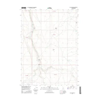
2017 Map of Salls Crossing
USGS Topo · Published 2017About this map
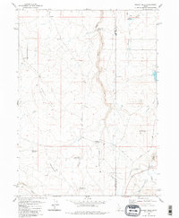
Clover Cr and Deadwood Cr carve deep channels through this high desert plateau in Owyhee County, defining a landscape of canyons and expansive flats. The topography is dominated by the Mount Bennett Hills and the dramatic incision of the East Fork Bruneau Canyon, where the drainage of Big Flat Cr and Three Cr meet. This 2017 survey details the remote cattle country and water management infrastructure essential to the region, including the Shirk Reservoir, Grassy Hills Reservoir, and Seventy-One Draw Reservoir. Named for its traditional stream passage, Salls Crossing serves as a central landmark amidst the surrounding terrain of Doe Flat and Buck Flat. The map also traces the winding Crawfish Loop Rd, the primary artery through these draws and canyons, and notes several named drainages like Aikers Draw and Seventy-One Draw.
Find a feature on this map
22 named features on this map. Tap any name to fly to it.
Don’t see what you’re looking for? This feature index may not catch every label — zoom into the map to look around manually.
Map Details
Editions of this 2017 Salls Crossing Map
This is the sole edition of this map. No revisions or reprints were ever made.
Other maps of this area

1955 · Twin Falls
USGS Topo · 1:250,000

1958 · Twin Falls
USGS Topo · 1:250,000

1979 · Salls Crossing
USGS Topo · 1:24,000

1979 · Mosquito Lake Butte
USGS Topo · 1:24,000
1979 · Three Creek
USGS Topo · 1:24,000
1979 · Murphy Hot Springs
USGS Topo · 1:24,000

1979 · Coonskin Butte
USGS Topo · 1:24,000

1980 · Juniper Butte
USGS Topo · 1:24,000
1980 · Curtis Draw
USGS Topo · 1:24,000
1980 · Grassy Hills
USGS Topo · 1:24,000