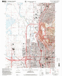
1998 Map of Salt Lake City North
USGS Topo · Published 2001About this map
Salt Lake City and its northern suburbs are captured here at a pivotal moment of preparation for the global stage. This 1998 revision highlights the Salt Palace Convention Ctr (2002 Olympics Site), marking the city's transformation as it readied for the Winter Games. The urban landscape is anchored by the State Capitol and the Cathedral of the Madeleine, while the western edge is dominated by the sprawling infrastructure of the Salt Lake City International Airport.
Find a feature on this map
71 named features on this map. Tap any name to fly to it.
Don’t see what you’re looking for? This feature index may not catch every label — zoom into the map to look around manually.
Map Details
Editions of this 1998 Salt Lake City North Map
This is the sole edition of this map. No revisions or reprints were ever made.
Other maps of this area

1885 · Salt Lake
USGS Topo · 1:250,000

1885 · Tooele Valley
USGS Topo · 1:250,000

1925 · Ft. Douglas
USGS Topo · 1:125,000

1928 · Ft. Douglas
USGS Topo · 1:125,000

1950 · Fort Douglas
USGS Topo · 1:24,000

1951 · Fort Douglas
USGS Topo · 1:24,000

1951 · Saltair
USGS Topo · 1:24,000

1951 · Salt Lake City South
USGS Topo · 1:24,000

1951 · Salt Lake City North
USGS Topo · 1:24,000

1952 · Saltair NE
USGS Topo · 1:24,000