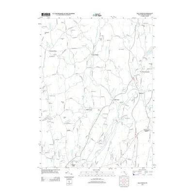
2013 Map of Salt Point
USGS Topo · Published 2013About this map
Wappinger Creek and its various tributaries, including Little Wappinger Creek and Great Spring Creek, define the drainage and settlement patterns of this corner of Dutchess County. The landscape is dotted with long-standing agricultural features like Breezy Hill Orchard, Terhune Orchards, and Clinton Vineyards, alongside several specialized farms such as Black Sheep Farm and Derry Dol Farm. Small hamlets such as Salt Point, Clinton Corners, and Netherwood serve as local centers, while the presence of Upton Lake Cemetery and Crum Elbow Cemetery provides valuable data for genealogical researchers. The map also shows a concentration of recreational and youth camps, including Camp Victory, Camp Nooteming, and Jug Hill Camp, clustered near water bodies like Upton Lake and Nooteming Lake.
Find a feature on this map
162 named features on this map. Tap any name to fly to it.
Don’t see what you’re looking for? This feature index may not catch every label — zoom into the map to look around manually.
Map Details
Editions of this 2013 Salt Point Map
This is the sole edition of this map. No revisions or reprints were ever made.
Other maps of this area

1893 · Clove
USGS Topo · 1:62,500

1893 · Poughkeepsie
USGS Topo · 1:62,500

1894 · Clove
USGS Topo · 1:62,500

1894 · Poughkeepsie
USGS Topo · 1:62,500

1898 · Clove
USGS Topo · 1:62,500

1898 · Rhinebeck
USGS Topo · 1:62,500

1899 · Millbrook
USGS Topo · 1:62,500

1901 · Clove
USGS Topo · 1:62,500

1902 · Millbrook
USGS Topo · 1:62,500

1903 · Poughkeepsie
USGS Topo · 1:62,500