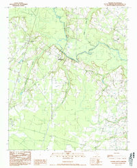
1990 Map of Salters
USGS Topo · Published 1990About this map
Salters and Lane anchor this coastal plain landscape in Williamsburg County, where the sprawling drainage of the Black River dictates the settlement pattern. The map reveals a region defined by extensive wetlands, including Laws Swamp, Boggy Swamp, and Thorntree Swamp, which frame the agricultural lands and scattered crossroads. Modern transportation infrastructure is represented by the CSX Transportation rail line, which cuts through the western portion of the quadrangle, connecting the small depots and rural communities.
Find a feature on this map
14 named features on this map. Tap any name to fly to it.
Don’t see what you’re looking for? This feature index may not catch every label — zoom into the map to look around manually.
Map Details
Editions of this 1990 Salters Map
This is the sole edition of this map. No revisions or reprints were ever made.
Other maps of this area

1943 · Trio
USGS Topo · 1:24,000

1943 · Bonneau
USGS Topo · 1:62,500

1946 · Kingstree
USGS Topo · 1:62,500

1946 · Indiantown
USGS Topo · 1:62,500

1949 · Georgetown
USGS Topo · 1:250,000

1967 · Georgetown
USGS Topo · 1:250,000

1974 · Georgetown
USGS Topo · 1:250,000

1986 · Georgetown
USGS Topo · 1:100,000

1986 · Kingstree
USGS Topo · 1:100,000
1990 · Blakely
USGS Topo · 1:24,000