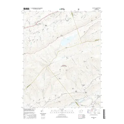
2016 Map of Saltville
USGS Topo · Published 2016About this map
Saltville and the industrial corridors of the North Fork Holston River define the southern edge of this landscape, where the topography shifts from river bottoms to the steep ridges of Clinch Mountain. This 2016 survey captures a region defined by its narrow valleys and extensive family burial grounds, including the Poore Cem, Vencill Cem, and Mutter Cem. The northern section is dominated by the Jefferson National Forest, featuring the high waters of Laurel Bed Lake and the peak of Short Mtn. Transportation history is visible through the Trail of the Lonesome Pine near Belfast, while smaller settlements like Allison Gap, Cardwell Town, and Lick Skillet illustrate the dense residential patterns that formed along the base of the mountains. The map provides a clear record of the complex terrain of Horton Valley and the various coves, such as Ward Cove and Whiterock Cove, that have shaped local settlement for generations.
Find a feature on this map
115 named features on this map. Tap any name to fly to it.
Don’t see what you’re looking for? This feature index may not catch every label — zoom into the map to look around manually.
Map Details
Editions of this 2016 Saltville Map
This is the sole edition of this map. No revisions or reprints were ever made.
Other maps of this area

1891 · Tazewell
USGS Topo · 1:125,000

1891 · Abingdon
USGS Topo · 1:125,000

1894 · Abingdon
USGS Topo · 1:125,000

1895 · Tazewell
USGS Topo · 1:125,000

1897 · Tazewell
USGS Topo · 1:125,000

1909 · Abingdon
USGS Topo · 1:96,000

1911 · Abingdon
USGS Topo · 1:125,000

1912 · Pounding Mill
USGS Topo · 1:62,500

1915 · Richlands
USGS Topo · 1:48,000

1916 · Pounding Mill
USGS Topo · 1:62,500