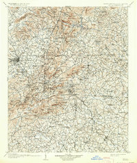
1907 Map of Saluda
USGS Topo · Published 1934About this map
Hendersonville and the surrounding mountain settlements of the Blue Ridge dominate this early 20th-century landscape, surveyed during a period of expanding rail access and rural industry. The Southern Railway line snakes through the mountains, providing a critical link for towns like Saluda and Melrose. Along the rivers, the infrastructure of an older economy remains visible in the numerous river crossings such as Whiteside Ford, Dickie Ford, and Mills Bridge.
Find a feature on this map
207 named features on this map. Tap any name to fly to it.
Don’t see what you’re looking for? This feature index may not catch every label — zoom into the map to look around manually.
Map Details
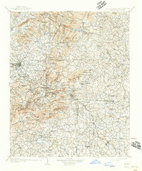
Editions of this 1907 Saluda Map
3 editions found
Other maps of this area

1888 · Pickens
USGS Topo · 1:125,000

1894 · Asheville
USGS Topo · 1:125,000

1894 · Pickens
USGS Topo · 1:125,000

1900 · Mount Mitchell
USGS Topo · 1:125,000

1901 · Asheville
USGS Topo · 1:125,000

1902 · Mount Mitchell
USGS Topo · 1:125,000

1905 · Morganton
USGS Topo · 1:125,000

1905 · Pisgah
USGS Topo · 1:125,000

1906 · Pisgah
USGS Topo · 1:125,000

1907 · Saluda
USGS Topo · 1:125,000