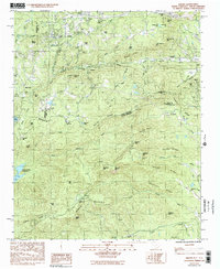
1983 Map of Saluda
USGS Topo · Published 1992About this map
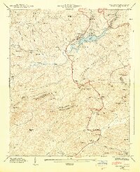
Saluda sits at the northern edge of this terrain, where the Southern railroad winds through the Blue Ridge mountains toward Tryon. The landscape is defined by the steep descent of the North Fork Pacolet River, featuring the landmark Pearsons Falls and the deep gorge near Melrose. This map captures the intricate boundary intersection of Henderson and Polk counties in North Carolina with Greenville County, South Carolina, a region of high peaks and river headwaters. Small rural communities and landmarks such as Valhalla and Melrose Mtn are connected by mountain roads, while the North Saluda Reservoir dominates the western slopes. Local life is anchored by country churches like Friendship Ch and Piney Grove Ch, and the local Jr High Sch in Saluda, providing a clear picture of the Piedmont-to-mountain transition in the early 1980s.
Find a feature on this map
72 named features on this map. Tap any name to fly to it.
Don’t see what you’re looking for? This feature index may not catch every label — zoom into the map to look around manually.
Map Details
Editions of this 1983 Saluda Map
2 editions found
Other maps of this area

1907 · Saluda
USGS Topo · 1:125,000

1935 · Hendersonville
USGS Topo · 1:24,000

1935 · Fishtop
USGS Topo · 1:24,000

1935 · Zirconia
USGS Topo · 1:24,000

1946 · Zirconia
USGS Topo · 1:24,000
1946 · Hendersonville
USGS Topo · 1:24,000

1946 · Cliffield Mtn
USGS Topo · 1:24,000
1947 · Hendersonville
USGS Topo · 1:24,000
1947 · Zirconia
USGS Topo · 1:24,000

1947 · Cliffield Mtn.
USGS Topo · 1:24,000