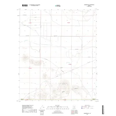
2018 Map of Samaniego Hills
USGS Topo · Published 2018About this map
Samaniego Hills rise sharply from the desert floor along the Pinal and Pima County border, framing a landscape defined by seasonal watercourses and historic ranching infrastructure. The Santa Cruz River and the Greene Canal traverse the northern flats, while the Los Robles Wash winds through the eastern reaches. The presence of Sasco Cem and Sasco Tank near the peaks of Cerro Prieto and Pan Quemado points to a localized history of settlement and water management in an arid environment. A network of rural roads, including La Osa Ranch Rd and E Sasco Rd, provides access to these isolated peaks, which have long served as prominent navigational landmarks in the Southern Arizona desert.
Find a feature on this map
29 named features on this map. Tap any name to fly to it.
Don’t see what you’re looking for? This feature index may not catch every label — zoom into the map to look around manually.
Map Details
Editions of this 2018 Samaniego Hills Map
This is the sole edition of this map. No revisions or reprints were ever made.
Other maps of this area

1934 · Tucson Mountains
USGS Topo · 1:125,000

1934 · Silver Bell
USGS Topo · 1:125,000

1934 · Newman Peak
USGS Topo · 1:125,000

1947 · Red Rock
USGS Topo · 1:62,500

1947 · Eloy
USGS Topo · 1:62,500

1948 · Eloy
USGS Topo · 1:62,500

1956 · Tucson
USGS Topo · 1:250,000

1958 · Tucson
USGS Topo · 1:250,000

1959 · Tucson
USGS Topo · 1:250,000

1959 · Vaca Hills
USGS Topo · 1:62,500