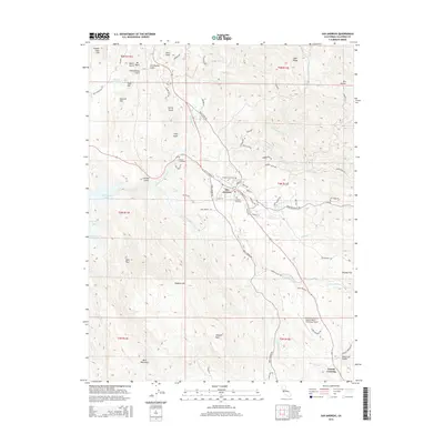
2015 Map of San Andreas
USGS Topo · Published 2015About this map
San Andreas serves as the focal point of this Mother Lode region survey, where the convergence of N Fork Calaveras River and several local creeks shaped the early development of the landscape. The town site is surrounded by three distinct burial grounds—Pioneer Cemetery, Peoples Cemetery, and Catholic Cemetery—reflecting the deep-rooted community history of the area. The terrain is defined by a series of named gulches and peaks, including Chili Hill, Pine Peak, and Hogback Mtn, interspersed with modern infrastructure like the Calaveras County Airport-Maury Rasmussen Field. To the west, the reach of New Hogan Lake and the Gourley Reservoir indicate the modern water management that supports the valley. Local industry and transportation are marked by routes such as Union Mine Rd and Cement Plant Rd, which snake through the hills toward outlying settlements like Brandy Flat and Fourth Crossing.
Find a feature on this map
81 named features on this map. Tap any name to fly to it.
Don’t see what you’re looking for? This feature index may not catch every label — zoom into the map to look around manually.
Map Details
Editions of this 2015 San Andreas Map
This is the sole edition of this map. No revisions or reprints were ever made.
Other maps of this area

1889 · Jackson
USGS Topo · 1:125,000

1892 · Jackson
USGS Topo · 1:125,000

1897 · Jackson
USGS Topo · 1:125,000

1902 · Jackson
USGS Topo · 1:125,000

1941 · Sutter Creek
USGS Topo · 1:62,500

1944 · Valley Springs
USGS Topo · 1:62,500

1944 · Sutter Creek
USGS Topo · 1:62,500

1945 · San Andreas
USGS Topo · 1:62,500

1947 · San Andreas
USGS Topo · 1:62,500

1947 · Sacramento
USGS Topo · 1:250,000
Featured Places
- Oak Park Estates, CA
- San Andreas, CA
- Fourth Crossing, CA
- Mountain Ranch Subdivision, CA
- Toyanza Subdivision, CA