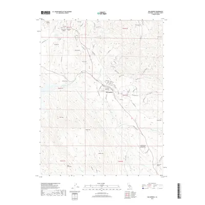
2018 Map of San Andreas
USGS Topo · Published 2018About this map
San Andreas serves as the focal point of this Calaveras County landscape, where the confluence of the N Fork Calaveras River and S Fork Calaveras River shapes the local topography. The town's historic footprint is evidenced by a cluster of local burial grounds including the Pioneer Cem, Peoples Cem, and San Andreas Catholic Cem. To the south and east, the terrain rises into the Bear Mountains and prominent peaks like Hogback Mtn and Joaquin Peak.
Find a feature on this map
86 named features on this map. Tap any name to fly to it.
Don’t see what you’re looking for? This feature index may not catch every label — zoom into the map to look around manually.
Map Details
Editions of this 2018 San Andreas Map
This is the sole edition of this map. No revisions or reprints were ever made.
Other maps of this area

1889 · Jackson
USGS Topo · 1:125,000

1892 · Jackson
USGS Topo · 1:125,000

1897 · Jackson
USGS Topo · 1:125,000

1902 · Jackson
USGS Topo · 1:125,000

1941 · Sutter Creek
USGS Topo · 1:62,500

1944 · Valley Springs
USGS Topo · 1:62,500

1944 · Sutter Creek
USGS Topo · 1:62,500

1945 · San Andreas
USGS Topo · 1:62,500

1947 · San Andreas
USGS Topo · 1:62,500

1947 · Sacramento
USGS Topo · 1:250,000
Featured Places
- Oak Park Estates, CA
- San Andreas, CA
- Fourth Crossing, CA
- Mountain Ranch Subdivision, CA
- Toyanza Subdivision, CA