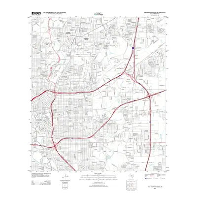
2013 Map of San Antonio East
USGS Topo · Published 2013About this map
The San Antonio River and Olmos Cr serve as the hydrologic anchor for this urban landscape, where the Olmos Reservoir and nearby San Antonio Springs mark the intersection of natural water sources and municipal development. The map reveals the dense residential and institutional character of Alamo Heights and Terrell Hills, while the western edge captures the preservation of the city's heritage through the Monte Vista Residential Historic District and the La Villita Historic District. Massive infrastructure projects define the era, notably the presence of the Alamodome and the complex web of highways including Ih 35 and Ih 10. Significant land is dedicated to the dead and the military, with the Ft Sam Houston National Cem and San Antonio National Cem serving as prominent landmarks for local history and genealogy research.
Find a feature on this map
37 named features on this map. Tap any name to fly to it.
Don’t see what you’re looking for? This feature index may not catch every label — zoom into the map to look around manually.
Map Details
Editions of this 2013 San Antonio East Map
This is the sole edition of this map. No revisions or reprints were ever made.
Other maps of this area

1953 · Schertz
USGS Topo · 1:24,000

1953 · San Antonio West
USGS Topo · 1:24,000

1953 · San Antonio East
USGS Topo · 1:24,000

1953 · Terrell Wells
USGS Topo · 1:24,000

1953 · Longhorn
USGS Topo · 1:24,000

1953 · Elmendorf
USGS Topo · 1:24,000

1953 · Southton
USGS Topo · 1:24,000

1953 · Castle Hills
USGS Topo · 1:24,000

1953 · Martinez
USGS Topo · 1:24,000

1954 · San Antonio
USGS Topo · 1:250,000