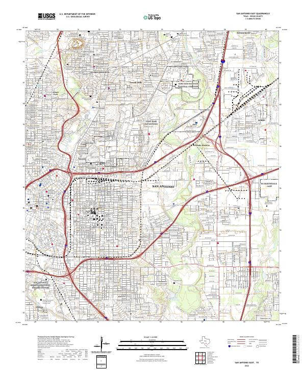
2022 Map of San Antonio East
USGS Topo · Published 2022About this map
San Antonio and its eastern suburbs are shown here in a complex landscape of military installations and deeply rooted civic history. The eastern extent of the downtown area is visible, including the Bexar County Courthouse and Cadena-Reeves Justice Center, giving way to the sprawling grounds of Joint Base San Antonio and the Fort Sam Houston National Cemetery. The map is particularly notable for its dense concentration of historic burial grounds south of E Houston St, such as City Cem 5, Confederate Cem, and Alamo Masonic Cem, which offer a genealogical record of the city's diverse heritage.
Find a feature on this map
67 named features on this map. Tap any name to fly to it.
Don’t see what you’re looking for? This feature index may not catch every label — zoom into the map to look around manually.
Map Details
Editions of this 2022 San Antonio East Map
This is the sole edition of this map. No revisions or reprints were ever made.
Other maps of this area

1953 · Schertz
USGS Topo · 1:24,000

1953 · San Antonio West
USGS Topo · 1:24,000

1953 · San Antonio East
USGS Topo · 1:24,000

1953 · Terrell Wells
USGS Topo · 1:24,000

1953 · Longhorn
USGS Topo · 1:24,000

1953 · Elmendorf
USGS Topo · 1:24,000

1953 · Southton
USGS Topo · 1:24,000

1953 · Castle Hills
USGS Topo · 1:24,000

1953 · Martinez
USGS Topo · 1:24,000

1954 · San Antonio
USGS Topo · 1:250,000