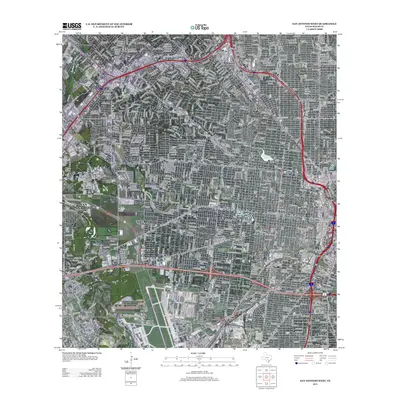
2013 Map of San Antonio West
USGS Topo · Published 2013About this map
Lackland Air Force Base anchor the southwestern portion of this map, reflecting the deep military history of western San Antonio. The landscape is defined by the density of the urban grid, punctuated by vital water bodies such as Woodlawn Lake and Elmendorf Lake. As the city expanded, older land uses like the Union Stock Yards remained prominent features of the industrial and transit corridor. Educational and spiritual landmarks, including St Marys Univ and several major burial grounds like San Fernando Cem Number 1 and San Fernando Cem Number 2, provide clear points of reference for genealogists and local historians. The map also traces the winding courses of Leon Cr and Zarzamora Cr, which flow through the residential developments of Leon Valley and Balcones Heights.
Find a feature on this map
26 named features on this map. Tap any name to fly to it.
Don’t see what you’re looking for? This feature index may not catch every label — zoom into the map to look around manually.
Map Details
Editions of this 2013 San Antonio West Map
This is the sole edition of this map. No revisions or reprints were ever made.
Other maps of this area

1953 · Culebra Hill
USGS Topo · 1:24,000

1953 · San Antonio West
USGS Topo · 1:24,000

1953 · San Antonio East
USGS Topo · 1:24,000

1953 · Terrell Wells
USGS Topo · 1:24,000

1953 · Longhorn
USGS Topo · 1:24,000

1953 · Macdona
USGS Topo · 1:24,000

1953 · Southton
USGS Topo · 1:24,000

1953 · Helotes
USGS Topo · 1:24,000

1953 · Castle Hills
USGS Topo · 1:24,000

1954 · San Antonio
USGS Topo · 1:250,000